Search

Travelling Photographer

Photos and commentary from my travels around the globe

Category

Hikes

Looking Back – YE Travels Ormond Beach to Pasadena #6 – Travelling through Colorado, Utah and Nevada

A lot of snow along this stretch – we spent New Years Eve in Moab UT then 3 hours we won’t talk about in the mountains of UT finally ending up in Ely NV in a blinding snow storm. Our goal was to make Dublin CA on the 3rd of January and we were successful.

Colorado


Nevada

Looking Back – YE Travels Ormond Beach to Pasadena #5 – Travelling through VA, Kentucky and Tennessee

Early start on the 28th and headed to Bristol which is on the border on Tenn. and Virginia. We tried to see a specific park and trail for some exercise and found that our GPS was useless in this area. So we wandered along the border between states and found the cities train station which caught my eye. Moving through Tennessee we stopped at Cumberland Gap and drove the auto route to the gaps top overlooking the valley.

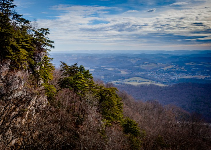
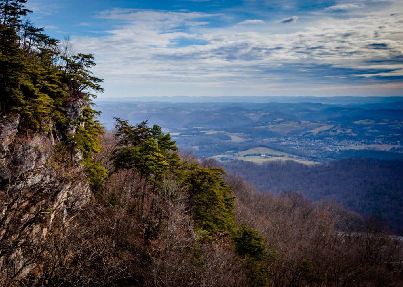
The gap is where the  borders of Tennessee, Kentucky, and Virginia converge, a path to new worlds appears. Early native Americans traveled through it along a game trail, before English-speaking settlers, including Daniel Boone, came through in the 1700s to carve out what became known as Wilderness Road. According to many accounts, between 200,000 and 300,000 settlers came through the Gap into Kentucky and beyond from 1775 to 1810.

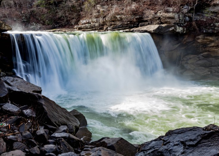
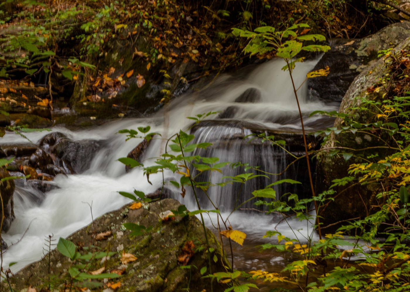
Moving on we stopped at Cumberland Falls SP – for some much need exercise after driving the twisting and turning RT 90 along the mountains ridge line. Known as the “Niagara of the South,” the 125-foot wide curtain of water is dramatic day or night. But it’s only at night during a full moon that you can see the moonbow.  The “moonbow,” also called a white rainbow or lunar rainbow, is formed just like a rainbow—light is refracted in tiny water droplets—and appears for the two or so days, as long as the sky is clear, on either end of the full moon. 

Pushing on we enjoyed the back road scenery of Tennessee then for the next two days we cruised through Arkansas and Oklahoma.
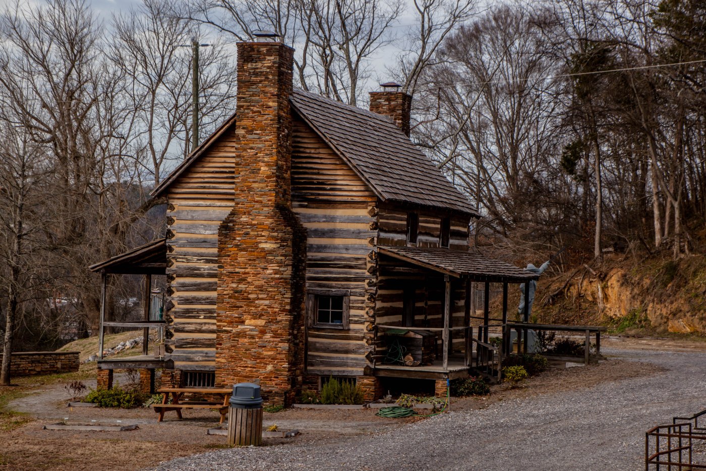
Bristol Va.

IMG_3351

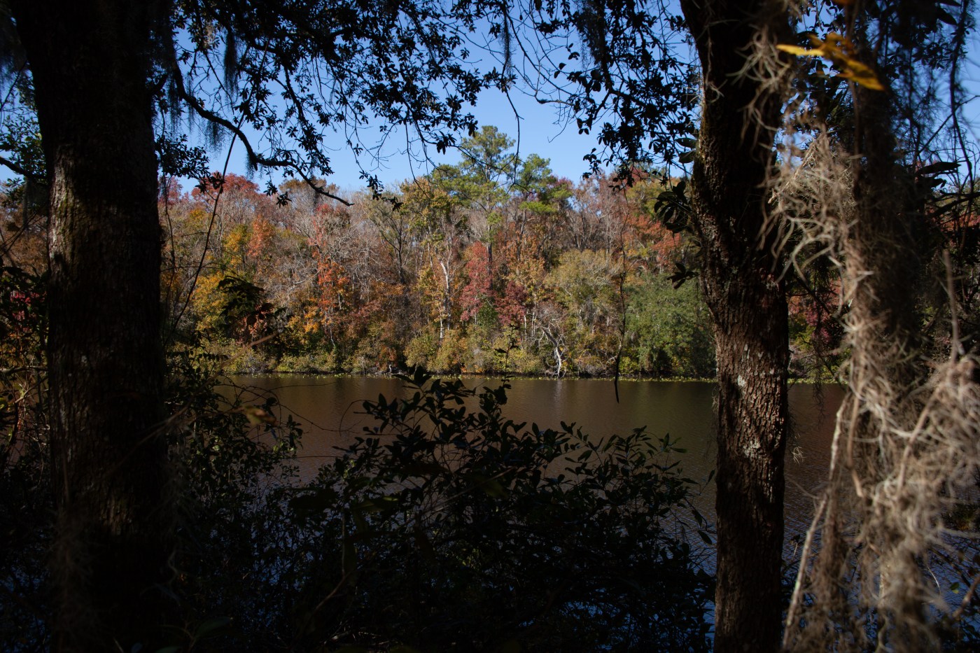
Cumberland Gap and Cumberland Falls SP

IMG_3355IMG_3369

Back Roads Tennessee

Looking Back – YE Travels Ormond Beach to Pasadena #4 – On the Road in NC

On the 27th we started our drive across country utilizing our preferred routing – off the interstates. We enjoyed the back roads of NC, a walk around the NC Zoo grounds to breakup the drive, a stop in Wilkesboro NC for lunch and a hike along The Cascades Falls Trail on the Blue Ridge Parkway. Wilkesboro is also the home of the legend of Tom Dooley (http://visitwilkesboronc.com/2013/05/23/the-tom-dooley-mystery/) – you should check it out — lunch at Dooleys Grill and Tavern was fantastic with sandwiches big enough for lunch and dinner.

Back Roads North Carolina


Cascades Falls Trail

Hiking Black Creek Ravines Conservation Area

You will see a remarkable number of different Florida landscapes here, with elevations ranging from five feet above mean sea level at points along Black Creek to 90 feet above mean sea level on the sandhills. Some areas within the conservation area are classified as being imperiled in Florida because of their rarity and vulnerability to natural or man-made factors. Consisting primarily of pine flatwoods, sandhills and wetlands, this property’s most distinctive characteristics are the seepage slopes and steep ravines that result from a series of naturally eroding seepage streams. These sensitive ecosystems support a wide variety of native aquatic and wetland-dependent species. About 2.7 miles of the south shore of Black Creek is protected to maintain the important recharge functions of the upland sandhill community.

One of the special highlights of this property is its ravine system, which is almost a mile in length and almost 95 feet deep. Ravines are created when an underground soil layer, typically comprised of dense clay, prevents rainwater from percolating downward through the soil layers and into the water table and instead forces the water to move laterally across the landscape, creating natural erosion that begins as a small gully and over time grows into a large ravine.  Additionally, one of the features not to be missed at Black Creek Ravines is the spectacular overlook of Black Creek. The bluff stands almost 30 feet above the creek, an elevation rarely seen in Florida and provides a breath-taking view of the creek.

Trekking in Northern Georgia – Day 2 & 3

Day 2

Early morning hike along the High Shoals Trail passing Blue Hole Falls and ending at Shoals Falls. This 2.4 mile trail was well marked and described at the trail head except for one important point -a bridge over the stream to the falls was out. It was a quick wake-up fording the stream – glad I wasn’t doing it in the spring.

Moving on to Brasstown Bald which is the highest point in the U.S. state of Georgia. Located in northeast Georgia, the mountain is known to the native Cherokee people as Enotah. The bald is 4783 feet above sea level. You could hike from the parking lot to the bald but after doing the High Shoals Trail I opted for the parks shuttle bus — but I did hike down to my car.
 
My next stop was Anna Ruby Falls.  Anna Ruby Falls is a pair of beautiful waterfalls, cascading in tandem through a beautiful slice of North Georgia forest. The twin waterfalls spill from a towering cliff in wispy white tendrils before splashing and pooling over mossy boulders.    
 
The final hike of the day was Dukes Creek Trail  a moderate 2 miles out and back through a beautiful, mountain stream-filled forest in Georgia just north of Helen. The trail descends alongside a shallow, mossy stream, hiking to several large, cascading waterfalls that tumble at the convergence of Davis Creek and Dukes Creek. At trails end the main attraction is a multi-tiered, 150-foot-tall drop of Dukes Creek Falls.  
High Shoals Trail

Brasstown Bald


Anna Ruby Falls


Dukes Creek Falls


Day 3

Awoke to a light rain so I donned rain gear and headed out. First stop was Helton Creek Falls. Helton Creek Falls cascades in a set of two waterfalls, sliding down a beautiful, hemlock-

filled creek valley.  Getting there was half the fun – fording two streams and hoping the Rouge
was going to make it.
The weather went down hills as I headed to Amicalola Falls. Amicalola Falls is a 729-foot waterfall on Amicalola Creek in Dawson County, Georgia. It the highest waterfall in Georgia and is considered to be one of the Seven Natural Wonders of Georgia. The name “Amicalola” is derived from a Cherokee language word meaning “tumbling waters”.
Too bad I didn’t make it — the rains were so heavy I need to pull off the winding mountain roads because the wipe couldn’t clear the windshield. When I arrived at the park the ranger didn’t advise hiking to the falls — so I headed south to Ormond Beach — but is was a fun trip. You can check out Amicalola here:https://www.atlantatrails.com/amicalola-falls
Helton Creek Falls

2019 Europe & Africa Trip – Day 25 – Italy – The Chianti Region

Our first real rainy day in 25 but it didn’t stop us from driving around the area stopping for tastings and checking out the city centers. Our stops included:

– Castellina   – Radda     – Gaiole     – Greve – home of Verrazano    – Panzano

2019 Europe & Africa Trip – Day 19 – VF Sunrise hike, Vulture feeding – travel to Botswana & Sunset Game Viewing Cruise on Chobe River

Early wake-up and bus to Victoria Falls for a Sunrise hike to see the suns magic on the falls along with the possibility to see rainbows. Back to our lodge for the 1:00 vulture feeding (these birds are near extinction because of limited natural food). Then on to Botswana and an evening game cruise.  A 2 hour + cruise along the Chobe River watching the wild animals return to the river for their evening drink.

2019 Europe & Africa Trip – Day 18 – Mosi-oa-tunya (Victoria Falls)

Packed day today – starting with a 2 mile walk along the falls eastern bank. Then a walk with 9 mo old lions followed by a rollicking dinner & drum show.

The falls are running at their low water flow mark (spring rains have not arrived yet) but still the amount of water generates a heavy mist. Our guide tells us when flowing at full force the best view is from a helicopter.
Continuing our packed day – we went to a lion rehabilitation reserve for a stroll with 2 – 9 month old cubs then rushed to a dinner show where we were given some African garb and were treated to the tastes of Africa. Grilled lamb, impala, guinea hen, crock, kudu and wort hog. Everyone received a drum and tried to play with the group. A face painter was painting African animals on faces but he screwed up when he came to me.

2019 Europe & Africa Trip – Day 13 – eSwatini to Kruger National Park

Another long travel day today with a couple of stops to break up the trek. This morning we stopped at the Ngwenya glass factory for a tour of the production facility ( they only use recycled glass) and another way to back stop the eSwatini economy. A few hours later we again crossed the boarder back into South Africa (eSwatini (Swaziland) is land locked with in South Africa and is a one man monarchy). We stopped at the Matsamo Cultural Village to learn about Swazi traditions, customs and an African lunch. The onto Hazyview South Africa the door step to Kruger. Up an at them at 4:45 tomorrow and an 8 hour game  drive (3 down & 2 to go).

Blog at WordPress.com.

Up ↑