Arches National Park lies north of Moab in the state of Utah. Bordered by the Colorado River in the southeast, it’s known as the site of more than 2,000 natural sandstone arches, such as the massive, red-hued Delicate Arch in the east. Long, thin Landscape Arch stands in Devils Garden to the north. Other geological formations include Balanced Rock, towering over the desert landscape in the middle of the park.
Never had the time to complete documenting our summer travels with our granddaughter – so the next couple of posts will cover the rest of our Utah travels.
Monument Valley Tribal Park AZ /UT
Monument Valley, a red-sand desert region on the Arizona-Utah border, is known for the towering sandstone buttes of Monument Valley Navajo Tribal Park. The park, frequently a filming location for Western movies, is accessed by the looping, 17-mile Valley Drive. The famous, steeply sloped Mittens buttes can be viewed from the road or from overlooks such as John Ford’s Point.
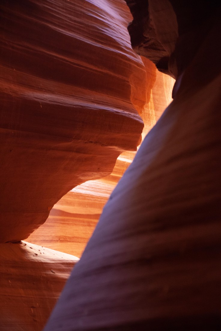
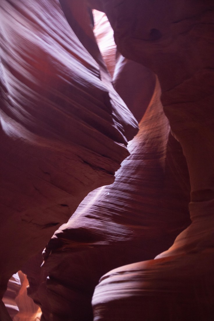
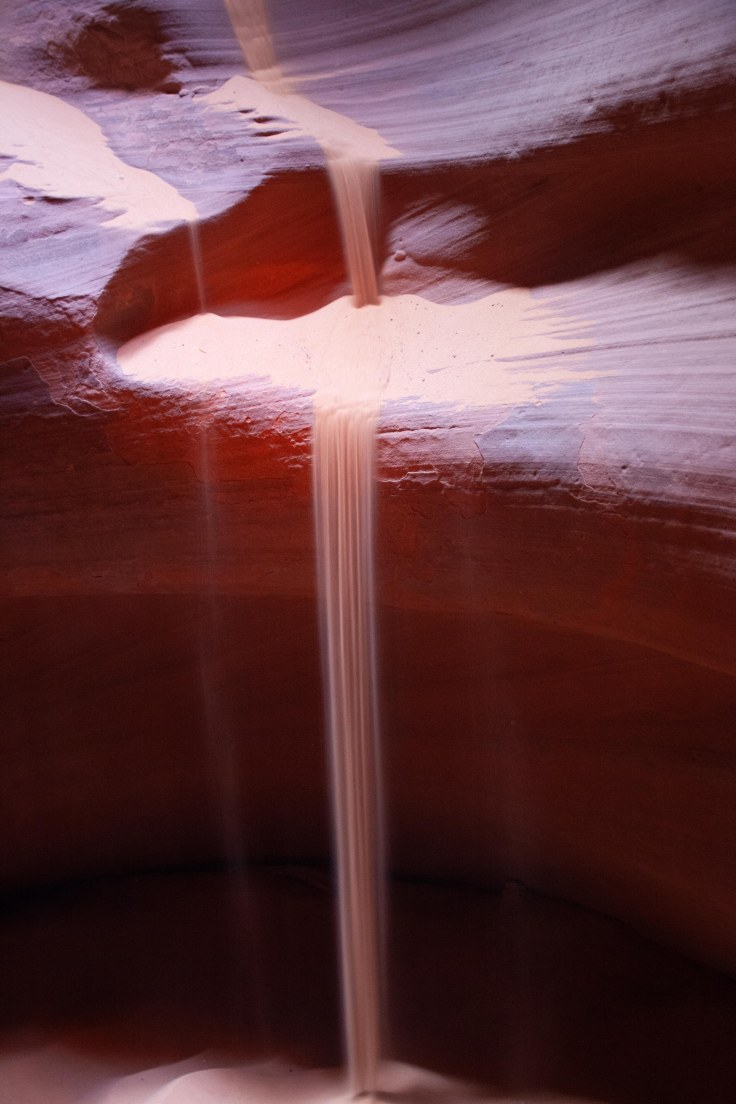
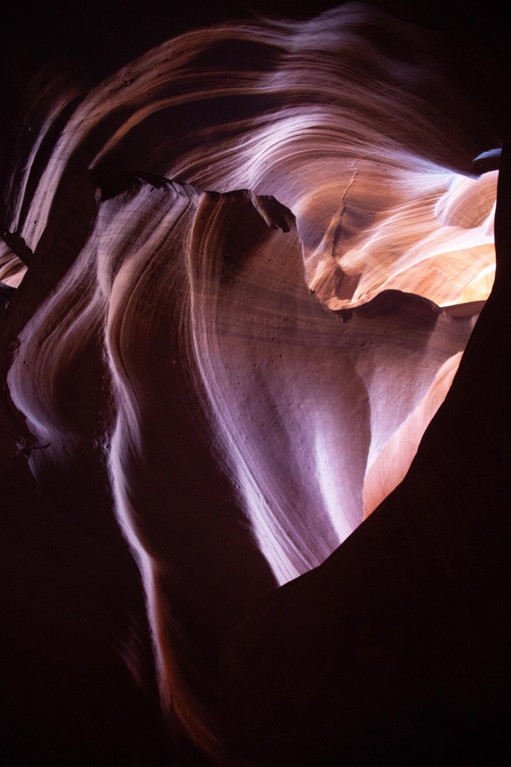
Mexican Hat Utah
The village itself is small, home to fewer than 100 people but the surrounding scenery is exceptional and not often visited, featuring 1,200 foot sandstone cliffs at the edge of Cedar Mesa, deep, layered canyons of the San Juan River, vast sandy desert plains, and a wide valley studded with isolated red rock buttes and mesas.
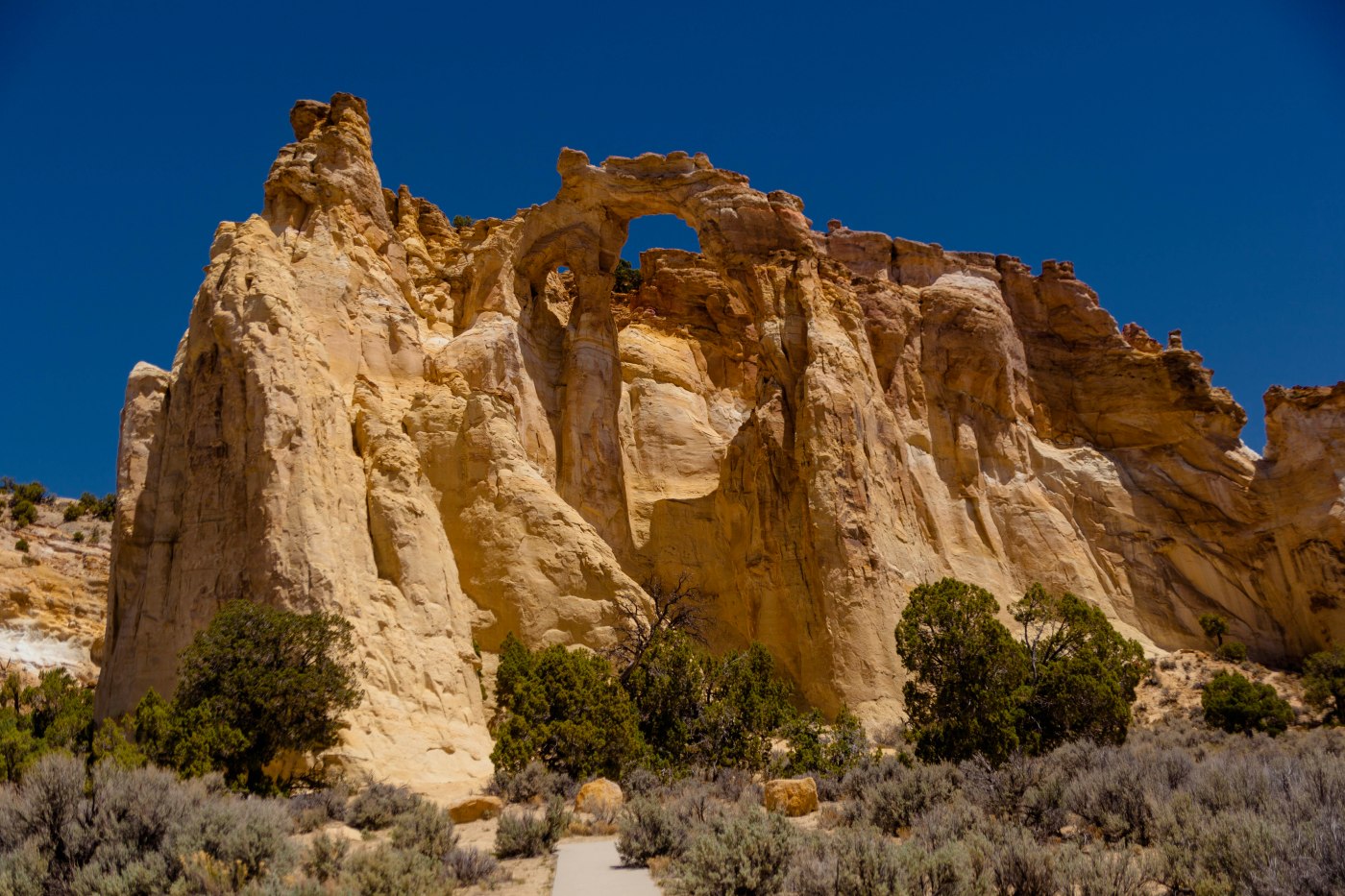
Kodachrome SP and Grosvenor Arch
As you drive on the bumpy dirt road towards Grosvenor Arch, you see miles and miles of sage brush on rolling terrain. So when you finally arrive at the arch, this sandstone structure’s massiveness is jaw-dropping. Sheer and colossal cliffs—quite an impressive sight, indeed. The “arch” is actually two arches, which tower 150 feet above the ground. The largest arch is nearly 100 feet in diameter. In 1949, the arch was named in honor of National Geographic Society president Gilbert Hovey Grosvenor, who became the first full-time editor of the National Geographic magazine. Grosvenor Arch is part of the Grand Staircase-Escalante National Monument (formerly part of Kodachrome Basin State Park), and is one of the biggest such arches within the monument. Poised at the end of a sandstone ridge, Grosvenor Arch feels remote, but is in close proximity to Kodachrome Basin State Park.
The left and center photos are from the Angel’s Palace Trail, a 1.5-mile hike that boasts some of the area’s finest views from over 100 feet above the canyons floor.
After spending 3 months in Florida including Christmas week with our entire family and a long weekend with my highschool friends and their spouses we headed back to Pasadena. I’m getting prepared to have my left knee replaced after success with having the right knee done last August. Hiking and walking to build up some strength drove me to walk the Arroyo and revisit some sites which make me remember why Pasadena is such a lovely city.
This was my second trip to Upper Antelope Canyon where our hike started at 10:30 am as opposed to the last time when it was at noon. The slot canyons were as beautiful as I remembered. I found this a better time for photography because of a softer light vs. direct overhead light at noon. Note that the featured image is that of a heart — didn’t see that last time. Check out my website for the differences between each shoot (new photos should be posted later in the week).


On the 31st we drove through the East Side tunnel to leave Zion (interesting – a little less than a mile long but it has 5 cutouts in the tunnel walls where you can get views of the canyon) and stopped at the Canyon Overlook Trail for a hike over the canyon wall for a view back at Lower Zion Canyon and Pine Creek Canyon. Then off to the north rim stopping along the way at Checkerboard Mess to view the wind and water erosion along a bee hive mountain. Arrived at the north rim at noon and hiked the Bridal Path Trail and the trail to Bright Angel Point. We had dinner plans at the Grand Canyon lodge but we had time to see several viewpoints — Point Imperial, Vista Encantada and Roosevelt Point. Dinner was excellent in a dinning room with great canyon views.
Canyon Overlook / Checkerboard Mesa
Point Imperial, Vista Encantada
Arrived in Las Vegas after a flight from Raliegh on May 29th – our trip was with our grand-daughter Haley as an 8th grade graduation present – then drove to Zion for a late afternoon shuttle trip for an overview of the park. On the 30th we took several hikes including the Watchman trail, Grotto Trail, Emerald Pools trail, The Narrows, Court of the Patriarchs and on the 31st the Canyon Overlook trial as we moved on to the Grand Canyon.
As an tune-up to Haley’s graduation trip to the Big Five we took an easy stroll through William B. Umstead State Park a North Carolina state park in Wake County, North Carolina. It covers 5,599 acres nestled between the expanding cities of Raleigh, Cary, and Durham, North Carolina. The park has 22 miles of well shaded hiking trails along with many miles of mixed use trails. Our goal was to reach a massive downed oak tree that has been chain saw carved by local artists Jerry Redi and Randy Boni. The art work features animals, tree branches and leaves.


A Friday morning trip high up into the San Gabriel Mountains (5500+) confirmed we are nearing draught conditions again. Crystal Lake was almost non-existent and the surrounding mountains were snow-less. There is an effortless 1.33 mile trail to and around the lake which provides excellent views of the surrounding mountains and forest which has bounced back after the 2002 Curve Fire. The trailhead is 24 miles of winding road from Azusa along rt. 39. Leaving the lake I headed to the Lewis Falls trailhead about five miles back down the mountain about 2 miles before the Rincon ranger station. The trailhead is unmarked but its on a bend with a wide shoulder and one car parking areas just before and after.
The trail to Lewis Falls along Soldier Creek is a very short trail – one mile round trip – but this is no stroll through the woods. The last tenth of a mile is a completely unmaintained scramble and boulder-hop along the creek bed, and takes about as much time to traverse as the first 0.4 miles.


